How does Google Earth import several polylines to AutoCAD?

Asked By 50 points N/A Posted on -
qa-featured

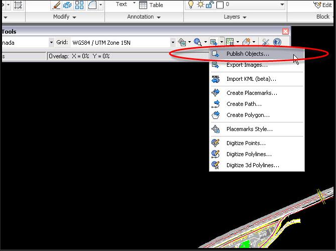
Hello fellow members.  I'm trying to use CAD-Earth to try to import/export JPEG images in Google Earth.  How does Google Earth import several polylines in 2D and 3D to AutoCAD?  I can't seem to find the import/export images option.  Any help would be highly appreciated.  Thanks guys.

SHARE
Answered By 0 points N/A #145056

How does Google Earth import several polylines to AutoCAD?

qa-featured

Hi,

With reference to your question, this option may be considered. One may digitize elements directly from Google earth or even to import KML into AUTOCAD. However, there is an application that is a sure solution although it is on 14 days free trial. Here is the link https://plexearth.com/


Related Questions