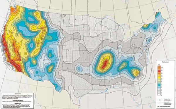
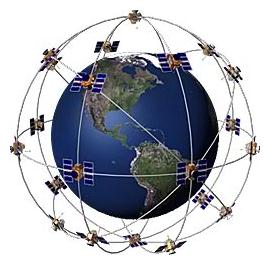
Functions and features of GIS and GPS
Asked By
0 points
N/A
Posted on - 04/06/2012

Is GIS and GPS has the same function and features? Please present me some clarifications. Thank you!


")


