GIS & GPS
Hello experts, I would like to learn coral draw and I am going to work with coral draw. Before that I need to learn the basic thing on that software. So I need corel draw software basic tutorials. I need the step by step tutorials. Please give some ideas and URLs to find them. Thanks.
- 809 views
- 2 answers
- 0 votes
Hello to everyone,
Am interested in knowing what are the ArcSDE Informix Database Minimum requirements for computer systems, especially on this topic:
- Supported Database Versions
- Supported Operating Systems
- Operating System Limitations
- 841 views
- 1 answers
- 0 votes
I am researching real time roadway traffic conditions, and since Big Data collects massive amounts of information, what amount of delay is expected from the time the data is collected, transmitted, processed, extracted, analyzed, and given meaningful results?
- 1079 views
- 1 answers
- 0 votes
Hello All,
I am using windows 7 OS on my machine.
I recently tried to run the ArcGIS setup on my system but in trying to do so, I was met with the following error on my screen:
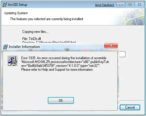
The error statement says:
Error 1935. An error occurred during the installation of assembly
‘Microsoft. MSXML2R ,processorArchitecture=’’x86’’,publicKeyT ok
en=”6bd6b9abf34538f”,version=”4. 1. 0.0”,type=”win32’”.
Please refer to help and Support for more information.
- 8154 views
- 3 answers
- 0 votes
Hi to All,
I am a user of ArcGIS server and have recently installed it on my machine.
Every time I try to access the server, I fail and it results in the following error:
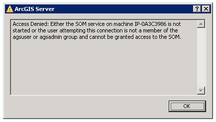
The error statement is as follows:
Access Denied: Either the SOM service on machine IP-0A3C3986 is not. Started or the user attempting this connection is not a member of the agsuser or agsadmin group and cannot be granted access to the SOM.
Can anyone please help me in finding a solution to the problem? if anyone has a solution, please do let me know, I'll be really grateful.
- 2232 views
- 1 answers
- 0 votes
Hi to GIS community,
I am a GIS engineer and facing some difficulties in initializing different GIS layers with ESRI.
When I try to add different layers on a GIS map, I get the following error on my screen:
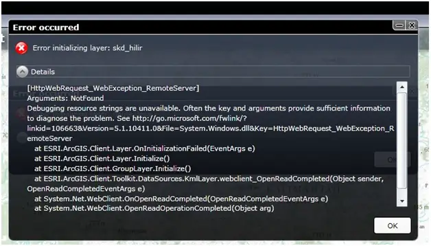
The error says:
Error occurred Error initializing layer: skd_hilir
Details
[HttpWebRequest_WebException_RemoteServer]
Arguments: NotFound
- 1226 views
- 2 answers
- 0 votes
How is GIS being differ from GPS and Why do most technology now a days use GPS?
- 1851 views
- 2 answers
- 0 votes
I just bought a Garmin Oregon 450 a few months ago. It worked fine at first, then after several months, the display either go farther to the right or farther to the left. I have to recalibrate the screen almost as frequently as I am using it.
It also kept jerking to the right and I could not push any icons. Is this the cause of the new Garmin update I did?
What can I do to fix this problem?
- 1982 views
- 1 answers
- 0 votes
Hello everyone
Can anyone let me know How to collect, process and integrate Global Processing System data with GIS?
Thanks
- 1017 views
- 3 answers
- 0 votes
Is GIS and GPS has the same function and features? Please present me some clarifications. Thank you!
- 1216 views
- 2 answers
- 0 votes


