Difference between GIS and GPS

Asked By 50 points N/A Posted on -
qa-featured

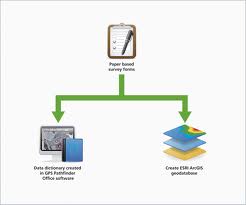
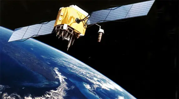
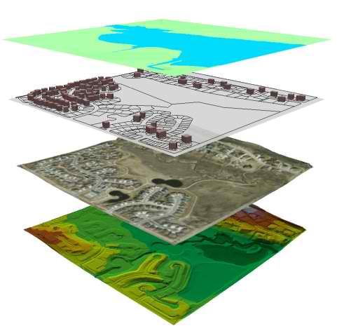
How is GIS being differ from GPS and Why do most technology now a days use GPS?

SHARE
Best Answer by Sharath Reddy
Answered By 0 points N/A #140877

Difference between GIS and GPS

qa-featured

GPS stands for Global Positioning System, is a way to locate specific places on planet Earth. It is a technology that comprises of satellites. It operates in a way that radio signals are being transmitted to GPS receivers thus certain parts of the earth can be specifically located by this technology called GPS.

On the other hand, GIS stands for Geographic Information System is a computer program that has the ability to view geographic locations on earth. GIS is more detailed compared to GPS in a way that every location that is viewed by GIS one can also find specific details about the said location like its relationship to other locations and detailed inquiries about the location itself.

GPS locates where the place is while GIS looks into the details of that place.

Best Answer
Best Answer
Answered By 590495 points N/A #140878

Difference between GIS and GPS

qa-featured

GPS stands for Global Positioning System and is a satellite-based navigation system which consists of a network of 24 satellites that were placed into orbit by the United States Department of Defense. Its main purpose before was for military applications but was later made available to public during the 1980s.

It works anywhere in the world and in any weather condition available 24 hours a day and the best part is that you don’t need to pay any subscription fees to use it. The 24 satellites that make the GPS space segment are orbiting 12,000 miles above the earth. The first GPS satellite was launched in 1978 and the complete constellation of 24 satellites was completed in 1994.

Each satellite is meant to last for about 10 years and they are constantly building replacements and launching them into orbit.

Photo of one of the satellites orbiting earth that forms the GPS navigation system

GIS stands for Geographic Information System and is used to combine software, hardware, and data for managing, acquiring, displaying, and evaluating all types of geographically referenced information.

It lets you to understand, interpret, view, visualize, and question data in different ways in the form of globes, maps, charts, and reports that will show the trend, relationship, and pattern. It is being used by thousands of organizations especially in the government to solve problems in different areas.

Images of GIS maps and layers

Related Questions