
Satellites have been standing watch on our planet for some time, helping us track all sorts of changes and activities on Earth. Modern satellite cameras monitor both urban and rural areas, tracking pollution plumes, changes in vegetation, and plenty of other data crucial for studying our urban ecological environment. One of the primary satellite camera uses is to identify problematic areas in urban environments to come up with adequate solutions for improving life and air quality in densely populated areas. However, there are more ecological and environmental reasons for urban monitoring with satellite cameras, discussed in more detail below.
Satellite Platforms for Monitoring Urban Areas: Top Objectives
The primary goal of using satellite cameras in industrial regions is to see the track of urban areas and pollution. Can scientists study pollution using satellite remote sensing? Yes, and this is exactly the main objective of monitoring urban areas from space using satellite cameras. By studying the atmospheric composition, satellite cameras measure greenhouse gas levels, particularly carbon dioxide and nitrogen dioxide. Both accumulate in our atmosphere, eventually leading to global warming; both also result from human industrial activity and have been steadily rising in urban areas since the 1900s. Today, there are several areas satellite cameras focus on while accessing ecology in urban areas.
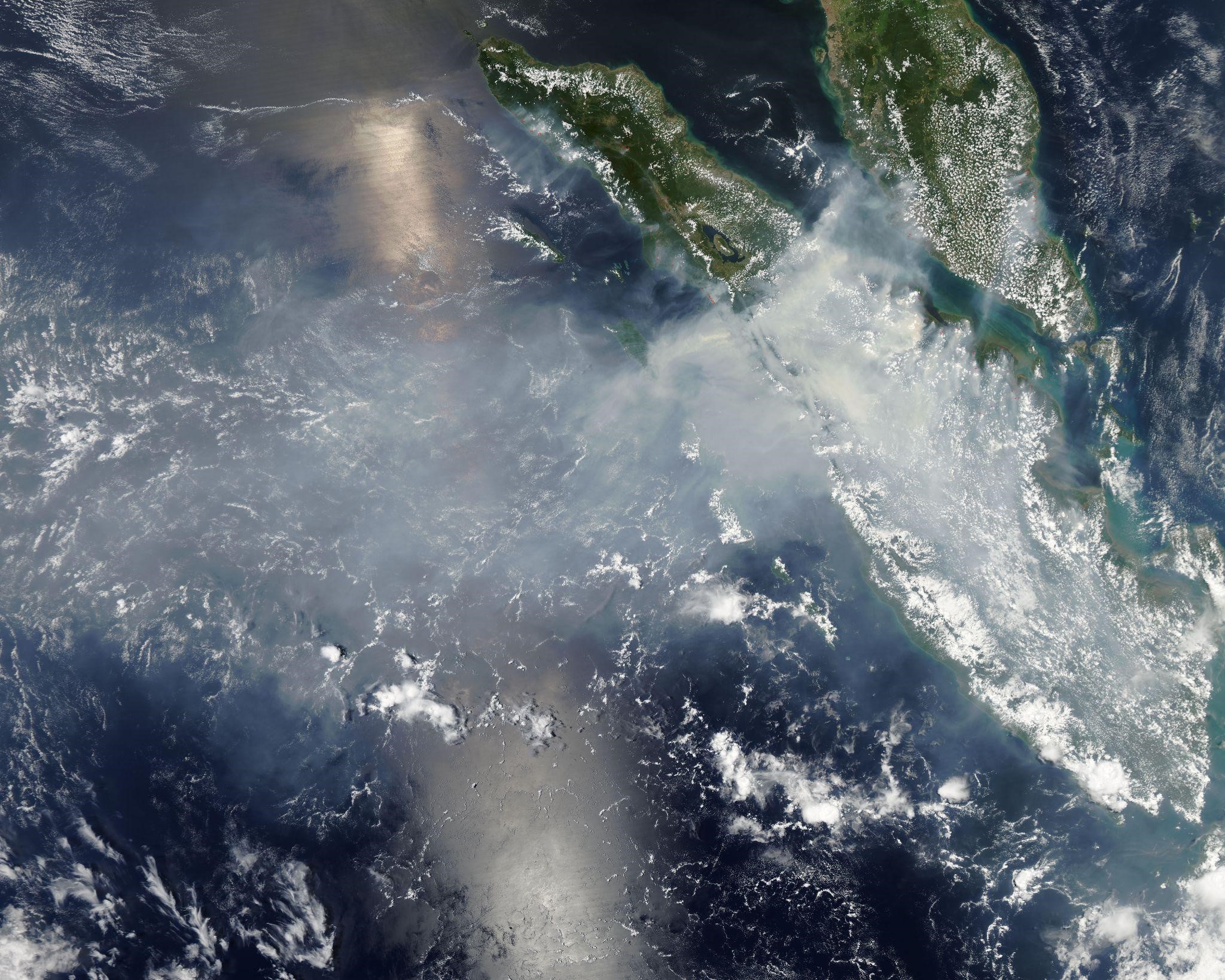
Tracking Pollutant Plumes
Over the last decade, satellite cameras have relied on infrared sensors for tracking pollutant plumes. As the light scatters from the plume, an infrared camera sensor captures it from the ground, giving a detailed assessment of polluted areas. Satellite cameras also capture amounts of liquid and solid particles in the plume, and even though they cannot provide info on plumes’ chemical composition, they still offer valuable insight as to the spread of pollution.
Forecasting Air Quality
Mapping smoke extent data is further used in forecasting air quality in monitored regions. Using these data helps plenty of US Air Quality agencies come up with quantitative analysis and forecasting — particularly in regions where summer wildfires are common, like in Southern states.
Analyzing Exceptional Events
Environmental events are classified as exceptional if they affect air quality and cannot be reasonably controlled or prevented. Generally, they include dust storms, wildfires, and even fireworks. All of those potentially affect National Ambient Air Quality Standard, while satellite cameras are used to record and evaluate the consequences of exceeding the Air Quality standard threshold.
Estimating Industrial Pollutant Emissions
Even though natural events, like dust storms and wildfires, affect air quality in both urban and rural areas, the industrial effect of human activity on the ecology is far greater. Satellite cameras track anthropogenic pollution from plants, factories, and transport, too. Their primary focus is measuring methane and carbon dioxide emissions.
Monitoring Long-Term Pollutant Trends
All data obtained from satellite cameras should be considered together because it gives a more detailed picture of long-term pollution effects. Not all of those insights are alarming; for example, it has been proven that from 2005 to 2011, the NO2 levels in US cities dropped by over 30% with the economic recession. All of these data combined help researchers improve air quality models and life quality in big cities.

Satellite Camera’s Future Potential in Urban Monitoring
Most of the urban environment data we have now comes from LandSat and other large EOS systems, but which remote sensing satellite is most suitable for urban ecological studies? With the increased focus on small satellites and CubeSats, it is now possible to use more affordable space tech to achieve very similar goals. Modern CubeSat cameras offer high-resolution images and are way more cost-effective than large government tech. This means that satellite imagery is no longer something only large agencies can afford.
Today, satellite cameras help a variety of private businesses by offering valuable insight and analytics — not only when it comes to environmental monitoring but also with city planning, construction, and other industries. And it’s safe to assume that this trend will persist, meaning that more private companies will rely on satellite cameras for evaluating the impact of their industrial activity on the urban setting.
Timely identification of top urban areas problems helps scientists make informed decisions, beneficial both for city planning and keeping the environment safe. Satellite cameras provide next-to-real-time data and figures, making it possible to analyze the effects of human industrial activity on the environment and alleviate these consequences if necessary. Eventually, the primary purpose of monitoring urban and rural areas with satellite cameras is to ensure we use our planet’s resources reasonably without depleting them.


")


