
The term “GIS” is an acronym for Geographic Information System. As its name indicates, this software is specially developed to store the information, analyze, organize, manage, retrieve the information about geography and spatial data. Additionally, these software tools enable users to produce maps for interpretation. If a user desires to store the geographic data of a particular city, this software stores city-data as points, road data as lines, and boundaries as areas and aerial photos as raster images. However, the GIS software tool can be used in various fields like engineering, transportation, planning, management, telecommunications, business, and many more. There is processing in every GIS software called Geoprocessing. This processing takes datasets, works on those datasets, and gives the output accordingly.
The following are the top 10 GIS software and their features:
ETAP Software
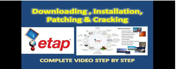
ETAP GIS software tool is the most-used tool. This tool includes transmission, sub-transmission, and distribution of the network. It also includes substation layouts and plant generation details. Additionally, it contains automatic electrical equipment, databases, analysis results represented on GIS electrical diagram, animated flow charts & alerts, direct communication, flexibility, GIS & ETAP data are represented graphically using multi-layers, etc. The ETAP GIS software also incorporates synchronization of GIS data to ETAP projects, controls modification, accept & reject actions, check data consistency, etc. This tool provides a free trial period.
ArcGIS ArcGIS offers a user-friendly interface to its users. It has powerful mapping features like viewing, analyzing, creating, and sharing maps and location information. It enables users to create beautiful maps that can be embedded in the website or any application. Additionally, it uses data-driven workflows, intelligent defaults, coordinated styling, and automated scale ranges. The scene viewer feature includes viewing, creating & sharing 3D scenes in a browser, adding data & layers to 3D maps, displaying data in pop-up windows, and infographics. This tool has its advanced version called ArcGIS Pro, which works better and has higher performance on a 64-bit processor.
Maptitude

Maptitude is the best GIS software used widely. It enables users to use all features and capabilities like maps, demographic data, etc. It includes features like banking, business, mapping, census data mapping, energy industry, franchise mapping, GIS mapping, GPS mapping, location intelligence, retail mapping, route mapping, satellite & aerial imagery, site & facility location, street mapping, web mapping, world mapping, and many more mapping features. This tool has been awarded as the Great User Experience 2018 Award and the Rising Star 2018 Award by FinancesOnline group.
MAPublisher MAPublisher GIS software offers seamless integration with adobe illustrator to provide advanced features to users. The tools of this software are organized in a great manner to carry the workflow. Its features include import & map geospatial data, view & edit data attributes, connect to spatial databases, ArcGIS online integration, users can create fresh styles with MAP themes, Avenza maps & the Avenza Map Store, geospatial PDF support, geoprocess quickly, select data with fewer clicks, etc. This application provides more flexibility with MAPublisher utilities.
eSpatial
eSpatial GIS software is All-in-One mapping software. This software enables users to transform business productivity through mapping. Its features include mapping sales territories, mapping customers, mapping business data, mapping routes, mapping resources, and mapping sales data. eSpatial tool offers a free trial period for new users. Additional features incorporated in this tool are planning & routing field sales teams, reveal data with heat maps, plot pins on an interactive map, identify opportunities with radius map, use annotations to give data context, sharing map as a template, eSpatial regional heat map, etc.
LocationIQ LocationIQ GIS software tool is specially designed for businesses of all sizes. This tool is very comfortable to use for businesses that work for vehicle tracking, IoT devices, geocoding, addresses, and timezones. Its features include 3D imagery, census data integration, geocoding, image exporting, internet mapping, labeling, map creation, map sharing, and spatial analysis. This tool also offers online training, webinars, and documentation for training for beginners. LocationIQ is compatible to work with iPhone, iPad, Android, web-based, cloud, and SaaS operating systems. The price of an advanced version of LoctionIQ starts $95.00.
MapInfo Pro
MapInfo Pro software tool is one of the best GIS software tools available with all mapping features. This tool works best with spatial analysis, map publishing, and search capabilities. MapInfo Pro is specially designed for large scale businesses to prepare data for mapping models. This software is compatible to work with only Microsoft Windows operating systems. Its features include geocoding, internet mapping, map sharing, spatial analysis, data visualization, demographic data, geofencing, and location tracking. Additionally, this software requires a reliable and good internet connection. Users need to pay a specific amount to access its features.
CARTO

CARTO software tool is the cloud-based platform that enables users to analyze and visualize data. This type of software tool is best suited for Banking & Insurance, Business Intelligence, Cities & Government, Retail, Transportation, Healthcare & Pharma, Education, and many more fields. This software tool is compatible to work on Web-based, cloud, SaaS, iPhone & iPad, and Windows operating systems. Additionally, it provides online training, webinars, documentation for learning effectively. The features incorporated in this tool are census data integration, geocoding, image exporting, internet mapping, interoperability, labeling, map creation, map sharing, spatial analysis, predictive analysis, strategic planning, etc. CARTO offers a free trial period for its users.
QGIS QGIS software tool for geographical visualization is an open-source tool available for everyone. It enables users to create and edit the geographical and spatial data. This software is compatible to work on macOS, Microsoft Windows, and Android operating systems. The complete software is designed in C++, Python, and Qt programming languages. QGIS software includes multiple features without paying a single penny. It incorporates the Printed Layout feature that enables users to prepare printed maps. This feature can also be used to add maps, views, labels, legends, etc. The best part of this tool is it requires less memory and less processing power. So, it offers a provision to users to install it on any older version of PC.
CleverMaps

CleverMaps software tool is specially designed for business purposes. Additionally, this tool is best suited for analysts & location planning, market potential & share, network optimization, customer segmentation, territory management, competitor analysis, etc. But, it can be installed on web-based, Saas, and cloud operating systems. This software provides live online tutorials, webinars, and documentation as training. Its features involve map integration, census data integration, map sharing, spatial analysis, analytics, customizable dashboards, OLAP, visual discovery, behavioral analysis, etc. CleverMaps software tool for geographical visualization offers a free trial for some days. Later, users need to pay a specific amount to access its features.


