Asked By
johnhegry
1180 points
N/A
Posted on - 07/20/2011

Greetings to all, I am posting here an error message screen that I encountered while using ArcGis, the error message goes like Failed to add Raster(s), this error message was displayed when I try add some world images from ESRI data disk package.
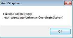
Failed to add Raster(s):
-esri_streets.jpg (Unknown Coordinate system)
I am wondering why I meet this error, while others are successful in adding those world images, honestly speaking I am not a genius in using ArcGis, that is why I am having a hard time in solving this issue, when I looked on the manual of the application, there no readme file that answers my problem, please comment on my post,
Thanks to all.
ArcGis Failed to add Raster
Dear Johnhegry
There are a few things to look:
Check the coordinate system of your raster in ArcCatalog. Did it have defined or not? If yes ok, and if not one of the coordinate systems, you may need to download the Projection Engine Expansion Pack for ArcGIS Explorer. You will set your coordinate system to WGS_1984_Web_Mercator_Auxiliary_Sphere.
If the above did not work, you can create a layer file of your raster in ArcMap and add that to explorer. If the above also does not work then try to create a layer package of your raster in ArcMap and adding that to explorer.
Take Care.
Jhony
ArcGis Failed to add Raster
Hi,
These problem might arise due to the conflicting auxiliary file (.aux files). This Auxiliary file might have been placed at the same location where the Raster file is located. It is a binary file that stores various types of information that includes statistics and spacial referencing. You need to place the Raster files at some other directory. You can use ArcCatalog for that purpose. You need to start windows explorer and move to the location where the raster file is residing. Now add the new raster in ArcMap and check in ArcCatalog. Hope this solves the problem.
Waters Magner


